When the Ground Shakes, Clarity Matters Most
Building a tool with Cesium and Julia to estimate earthquake damage in real-time doesn’t always start with a strategy doc. Sometimes, it begins with a half-baked idea scribbled in a notebook, long after everyone else has gone to bed. Some of the most important tools are born out of curiosity—and a little pressure to solve problems that aren’t abstract at all.
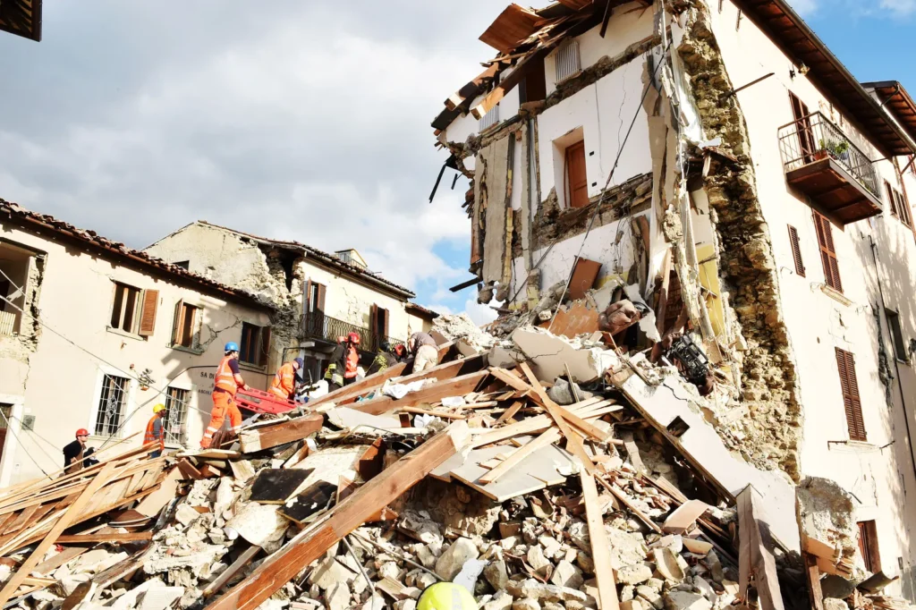
This idea—a real-time earthquake damage estimator—feels like trying to read the mood of the Earth itself. When everything is shaking, and nothing feels steady, people don’t just need help—they need clarity. Even a rough picture of how bad things might be, and where to respond first, can make all the difference.
Where the Idea Takes Shape
Not every project begins with polished diagrams and bulletproof specs. Sometimes, it starts with someone muttering, “There has to be a better way,” and then staying up too late chasing what that could look like.
The push to build a live earthquake damage estimator usually comes from a place of frustration—watching emergency crews waste precious hours figuring out which roads are cracked or which buildings are beyond saving. Even a simple, rough visual can save those first few critical hours.
Cesium brings the map to life in 3D. Julia crunches numbers with surprising speed. Together, they create a system that helps responders see the quake’s footprint—while it’s still happening.
Why Cesium and Julia Make Sense
There are plenty of mapping tools out there, but Cesium renders terrain with a realism that matters in disaster response. It can stream tile data and make it feel like a living place, not a cartoon.
As for Julia—it handles large datasets without breaking a sweat. Feed it seismic readings, structural blueprints, or even real-time social media reports, and Julia processes it calmly and quickly.
On the surface, Cesium and Julia might seem like tools from different worlds. But together, they produce a clear, dynamic snapshot of disaster zones—far better than static charts or delayed updates.
Modeling Damage: Where Math Meets Reality
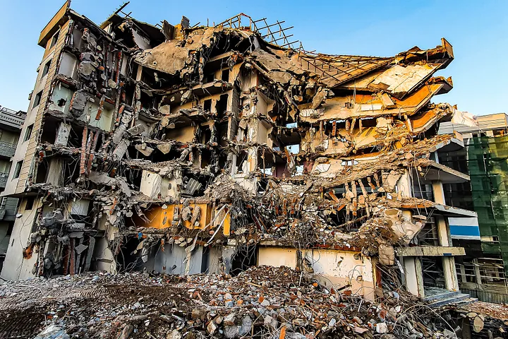
The numbers are the easy part. The hard part? Accepting that no model gets it 100% right. Earthquakes don’t follow manuals. Buildings don’t fail in predictable ways.
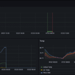
Julia ingests ground acceleration data, historical shake maps, structural info, and outputs probability grids. These grids show the chances that specific structures are severely damaged.
Even if it’s not perfect, a 65% risk signal is better than blind guesses. It guides decisions—where to look first, who might need evacuation, which bridges might be compromised.
A Simple Scenario: From Data to Decisions
Picture a mid-sized city—old brick downtown, some high-rises, a few suburban zones. A strong quake hits.
Sensors immediately start pushing out data. Julia parses the incoming stream, estimates potential damage zones, and highlights the riskiest areas.
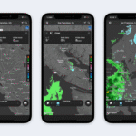
Then Cesium steps in: it overlays this data on a 3D city model in real time. The screen shows red danger zones near an old bridge, amber patches in high-density housing.
It’s not a high-concept academic tool—it’s a live operational map that tells responders where to go first.
And that map? Could literally save lives.
Real-World Hiccups Along the Way
Building this isn’t smooth sailing. Real-time tools break in unpredictable (and sometimes petty) ways:
- Some sensors fail at exactly the wrong moment.
- Cesium tiles may flicker or fail to load when the data gets dense.
- Models can overreact to noise, marking stable areas as collapsed.
But every failure teaches something. Better to break during a test drill than during the real thing.
Little Wins That Keep It Moving
Some tiny wins make a big impact:
- Switching Julia’s threading settings shaved 2 seconds off processing time.
- Pre-fetching Cesium tile data made visuals load smoothly during demos.
These small tweaks stack up. Eventually, the system clicks: no stalls, no glitches, just a fast, accurate readout of the quake’s impact.
That’s when the tool starts to feel like something people can really trust.
Beyond the First Hour
This system isn’t just useful during the quake. It helps in the days and weeks afterward too.
It can:
- Forecast road collapses and gas line ruptures
- Identify areas needing urgent power restoration
- Assist with insurance assessments and rebuilding plans
There’s a deeper ethical conversation here—about how data is used post-disaster. Helping people vs. negotiating payouts. It’s worth thinking about long before deployment.
What Makes It Worth It
Anyone can build a slick-looking dashboard. The hard part is making one that still works when the city is falling apart.
Every piece of planning, every failover backup, every drill test matters. Because when it counts, those details become the difference between confusion and clarity.
A Few Tips from the Trenches
Thinking of building something similar? A few hard-learned lessons:
- Always have backup data feeds. You’ll be glad you did.
- Keep models explainable. If you can’t summarize it in plain English, it’s too complex.
- Never trust the real-time connection. Assume it will drop.
- Use real data whenever possible. Simulated data can hide the ugly edge cases.
The goal is to minimize surprises when real life gets chaotic.
Conclusion
This tool isn’t about perfect predictions. It’s about providing clarity when people need it most.
Cesium makes the impact feel visible. Julia turns chaos into numbers you can act on. No, it’s not flawless—but it doesn’t have to be.
If it helps someone act faster, or safer, or smarter in the middle of the noise…
Then it’s already doing something that matters.
Read our more blogs-Building a Real-Time Monsoon Rainfall Predictor with Apache Spark and Mapbox